

Pole top photography - 2026-2027
Do you have livestock or animals?
From November 2026 to March 2027, we’re using a low-flying helicopter to take photos of approximately 47,500 rural power poles across our electricity network. Pole top photography allows us to quickly and effectively assess the condition of our network, check for defects, and monitor vegetation that has the potential to grow into lines.
We know that helicopters can sometimes unsettle animals, livestock or disturb outdoor events. If you have concerns or want to know if we’ll be in your area, please check the flight details below or get in touch using the form below.
Helicopter in your area
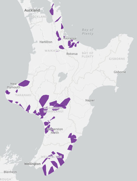
The work will be carried out in stages, starting in the Bay of Plenty, Coromandel, Hauraki and Matamata/Piako, Taranaki, Whanganui, Manawatū and Wairarapa regions. The flight areas are indicated by the purple blocks on the map – these are a general guide only. To check if your specific address is impacted, view our flight area map on the link below. If you think you are going to be affected, and want to talk to our team, fill in the form below or contact our general enquiries team.
Any helicopter operating outside of the specified dates and locations below, is unrelated to this piece of Powerco work.
Please note that dates are indicative only – in the event of bad weather, work will be rescheduled.
Note - no flying is being done from 15 December 2026 through to 10 January 2027.
Bay of Plenty - 25 November - 14 December
Coromandel - 8 December - 17 January 2027
Hauraki and Matamata/Piako - 8 December - 17 January 2027
Taranaki - 11-31 January 2027
Whanganui - 1 February - 7 March 2027
Manawatū - 1- 21 March 2027
Wairarapa - 15 - 26 March 2027
Contact our team
FAQs
Per Civil Aviation Authority (CAA) requirements, the helicopter will only be flying in open air space. That means it will fly above 300 metres in urban areas, and above 150 metres in rural areas.
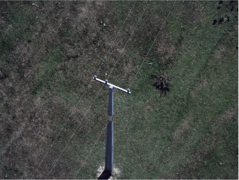
Your privacy will not be impacted by this work. We are only taking photos of our poles and crossarms, not residential properties. The photos are for internal asset assessment purposes only and are held in a secure location. Here is an example of the type of photos taken:
Drones can only last for a short period in the air before they need to be charged. It would require someone to travel with it on the ground across the network, which would be inefficient. A helicopter can run for several hours and cover much greater distances.
Aethon Aerial Solutions, who will contract local pilots to carry out the work.
Our electricity network stretches across the North Island, made up of about 264,000 poles. It is impossible for us to survey all of these in one summer, so we’ve been spreading out the surveys since 2018.
Depending on timing, we may be able to liaise with our flight crew so that people with animals can be given prior notice of when the helicopter is likely to fly over a specific area. Check the map above for your area, and if you'd still like to talk to a team member, please fill in the form above or contact our general enquiries team.