Project update
Pole top photography - Summer 2021-22
Between November 2021 and March 2022, we used pole top photography to survey 46,870 power poles on our rural electricity network
View more

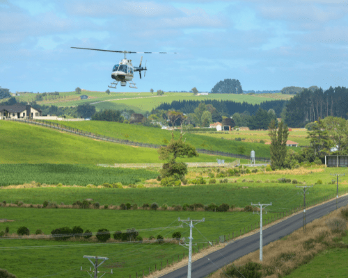
Between November 2020 and February 2021 we used LiDAR and pole top photography to survey and document much of our network:
We surveyed 16,833km of overhead lines and 32,068 rural poles
Covering rural Coromandel, Masterton, Wairarapa, Taranaki, western Bay of Plenty, and South Waikato
Each pole was photographed at least six times
Inspection revealed 160 previously unknown high-risk network defects that could be addressed. These have now been fixed.
We were conscious the helicopters might disturb animals or event our customers had planned, so we advertised the project via Facebook, digital advertising and in newspapers.
The Facebook and digital advertising saw more than 3,200 new people visit Powerco’s website to read more information about the project. Once there, customers were able to register concerns through an online form and 78 customers with concerns (mostly about livestock) contacted us through this method.
Our Customer Experience team contacted those customers to help work through issues and concerns.
“There was one customer in Wairarapa who was lambing the week we were to be flying over his property. While he was supportive of the work, he was understandably concerned how it would affect his animals,” says Maintenance Engineering Manager Carl de Haan.
“To help, we rearranged the flight schedule to avoid his property until after lambing.”
“There were other properties we chose not to fly over and survey altogether, when a customer’s concerns could not be allayed.”